15% off Tree Trimming & Removal until Feb. 1, 2026! Call us today to schedule your service!
General Services
- Topographic Surveying and Mapping
- Restoration areas – documentation of resource recovery, riparian zones
- Roadways and Timber harvest accessibility
- Digital Terrain Modeling
- High Quality Orthophotography
- RTK rectified ground control
- Accuracy reporting
Forestry Services
- Structure from motion
- Canopy Height Models
- Tree Height
- Lidar (future)
- Terrain Modeling
- Stand Volume (board feet)
- Habitat Detection
- Multispectral Orthoimagery
GIS Services
- GIS Needs Assessments and Implementation Planning
- GIS Analysis and Model Development
- GIS and GPS Training
- GIS/GPS Field Data Collection Systems
- Web-based GIS
Environmental Services
- Land Management GIS Support and Analysis
- Ecological Modeling
- GIS/GPS Field Data Collection Systems
Our WOrk
A Small Sample of Our Work
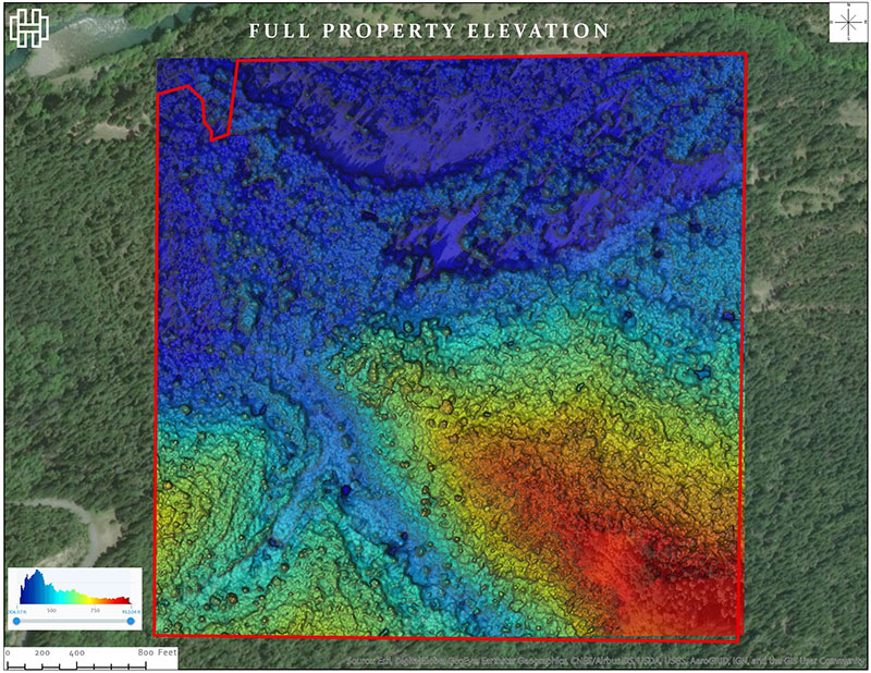
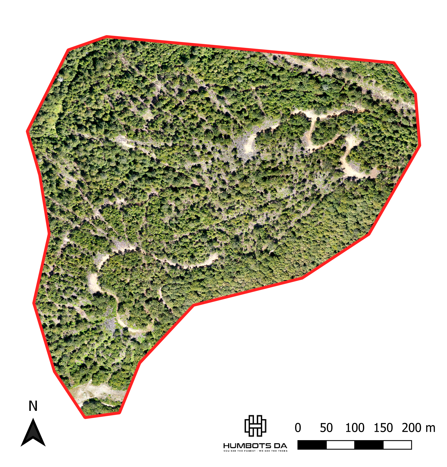
Full property elevation map, South Fork Eel River
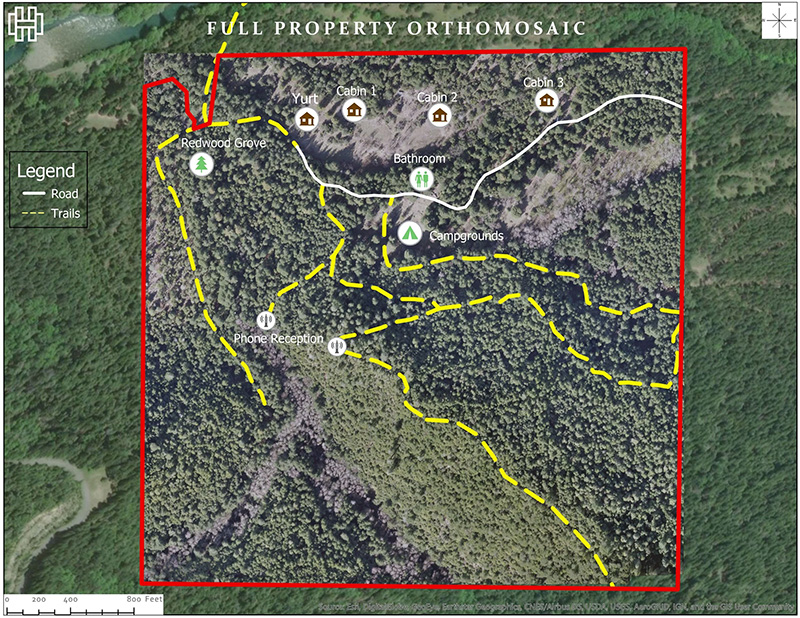
Full Property Orthomosaic, South Fork Eel River
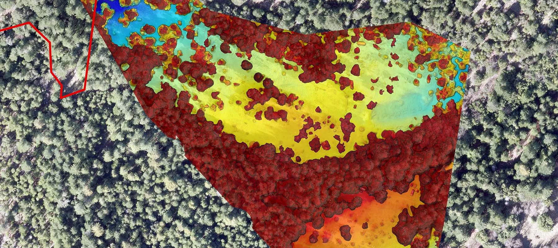
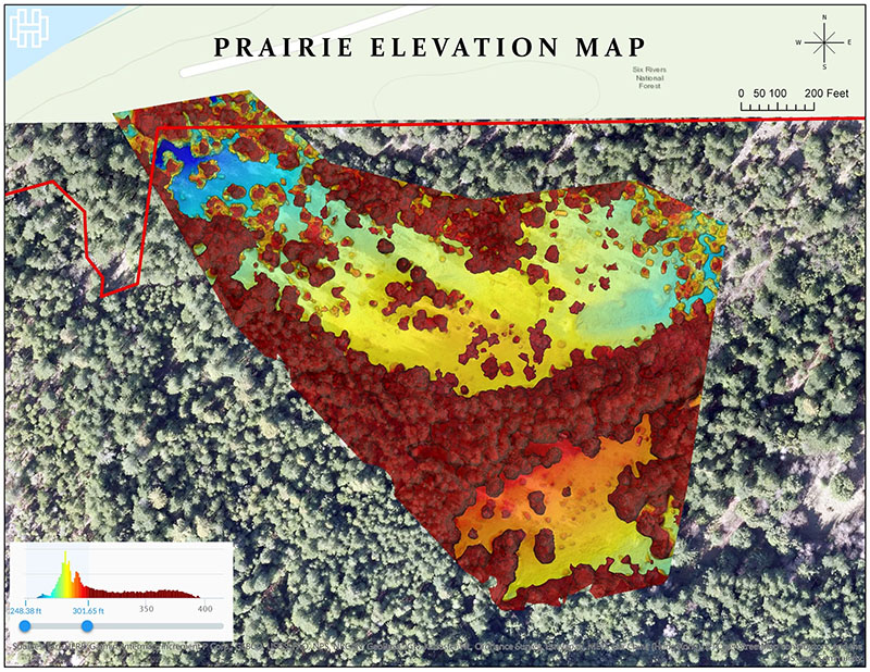
Prairie elevation map, South Fork Eel River
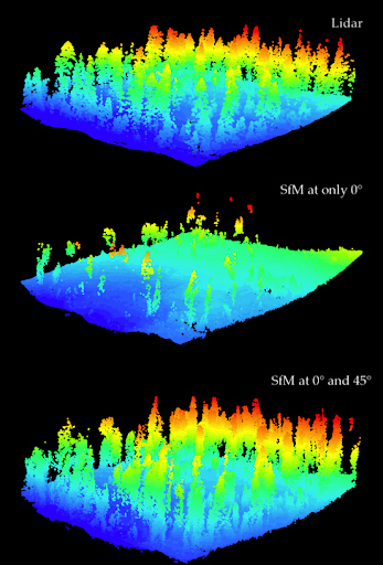
United States Forests Service – Caspar Creek Experimental Watershed, Mendocino CA. Map by James Lamping.
Masters Degree Research by James Lamping.
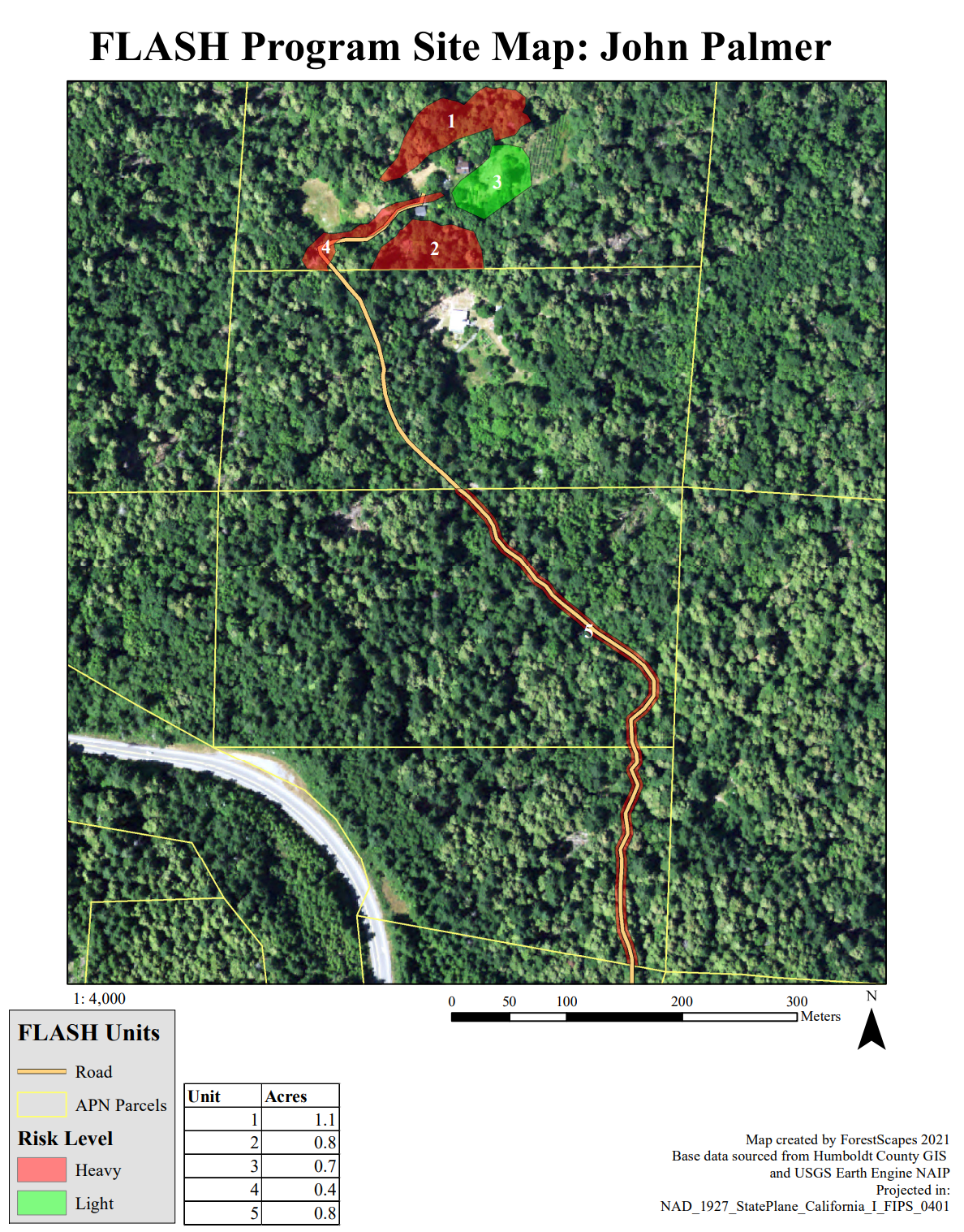
Defensible Space Map for Humboldt Counties FLASH program. Map by Mia Wapner.

Schedule an Assessment
Contact us today to schedule an assessment (free for properties in Humboldt County) or learn more. Call us at (707) 382-8702 or schedule an assessment online.